
Aerial Videography
Strengths of Aerial Videography:
-
Covers large areas relatively quickly
-
Helps measure large water bodies, especially lakes
-
Informs management actions of community organizations or regional planning initiatives

AERIAL VIDEOGRAPHY
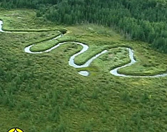
Aerial videography measures the health of riparian areas using video footage from low-level flights or drones that are flown along lake and wetland shorelines and river or stream banks.* This method was most commonly used between 2005-2015.
Riparian areas are scored and rated in one of 3 categories:
-
Good/Healthy
-
Fair/Moderately Impaired
-
Poor/Impaired
Like the Field-based Method**, the area is scored according to the amount of:
-
Area covered by any plant species, cattails and bulrushes, and woody plants (and signs of new growth)
-
Human alteration via bare ground, plant community alterations, or changes to the physical site (including banks
-
Human alteration via bare ground or changes to the physical site (including banks)
-
Shoreline or bank stability
*Note that there may be limitations or restrictions in the use of drones in certain areas. Ensure that you follow all applicable regulations.
** The similarity of the Aerial Method to the Field-Based Method is because this method was based on Cows and Fish's Field-based Riparian Health Assessment methods.
Aerial Videography Method Examples


GOOD
FAIR


POOR
